en Jawg Lab becomes Jawg App: a fresh new interface and more control over your account Jawg Lab has evolved with a new name, a fresh interface and more ways to manage your account. Read on to see what’s changed!
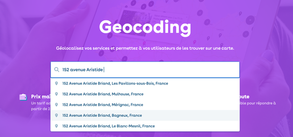
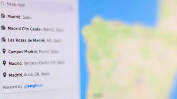
en Unlocking better geocoding: multilingual search, address interpolation and enhanced fallback We’ve made some exciting improvements to our geocoding API — multilingual search, better address interpolation, and enhanced fallback. Check out how these updates can improve your geocoding results.
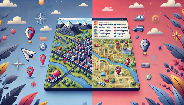
en MapLibre GL JS vs. Leaflet: Choosing the right tool for your interactive map Two popular open-source libraries for creating web maps are MapLibre GL JS and Leaflet. Both have unique strengths and cater to different needs. In this post, we'll explore the key differences between the two, helping you make an informed decision for your next mapping project.
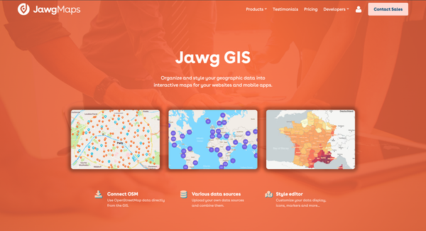
Nos Produits Discover Jawg GIS: a powerful tool for your more complex mapping projects If you work on complex mapping projects, Jawg GIS lets you organize and style your geographic data the way you want. Simply contact the Jawg team to request access.
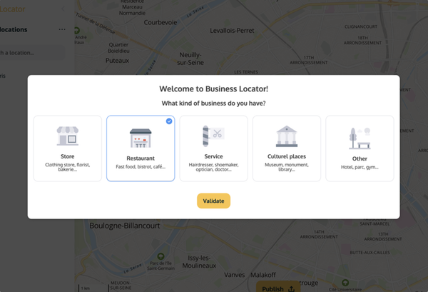
en Introducing BusinessLocator 2.0 In this article, we go over all the changes we made to BusinessLocator (there are quite a few!) in order to make it the best store location solution there is out there. Interested? Read on to find out more.
Nos Produits Geocoding redefined: what’s new in Jawg’s geocoding API and data framework Let's talk about how data is at the heart of geocoding, which sources Jawg uses for its API (and why), and how the project continuously evolves with the needs of the customer.
Parlons Tech Why you should use vector tiles rather than raster tiles for your maps Discover the three main reasons why it could be more interesting for you to use vector tiles rather than raster tiles for your maps.
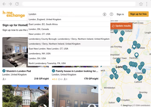
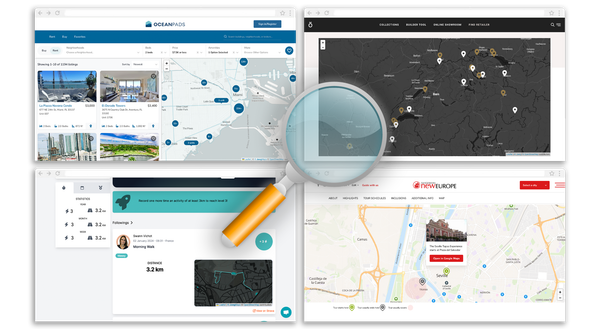
Nos Produits Showcase of international interactive maps Discover beautiful and functional maps created with the Jawg APIs: Frenzyrun, NewEurope, OceanPads and Roshults.
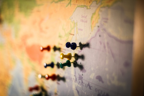
en What is geocoding and what is it used for? Geocoding combines mathematics, geography and computer science to transform a physical address into geographic coordinates. To illustrate, let’s go through an example.
Parlons Tech Introducing Jawg Places JS We are excited to release our new library Jawg Places JS, a fast and easy way to turn any HTML input into a search bar with autocomplete. This new library can also be used as a plugin for Leaflet, MapLibre GL JS and Mapbox GL JS.
Nos Produits New satellite imaging style Check out our brand new Jawg Maps style: jawg-satellite-streets, displaying beautiful satellite imagery! Available for France, Luxembourg, Monaco, Slovakia, Spain and Switzerland. More coming soon!
en Tutorial: How to create a map in the Jawg Lab Interested in creating beautiful dynamic maps? You’re in the right place! Thanks to our map editor, the JawgLab, you can add or import your data and customize the map to match your brand. But first things first, how do you create a simple map with a dataset? Follow this tutorial to get started.
Nos Produits Embrace the new streets-v2 tileset Discover our new tileset: streets-v2 with better language management, better 3D building, vector tile size reduced with various improvements.
Nos Produits Maps in your language Discover the new features of Jawg Maps : automatic language, road shield, static maps custom icons and logo position.
Nos Produits Jawg x Pelias Geocoding is the second most used service at Jawg (after base maps). We added this service in January 2017 and we are happy to have chosen the Pelias project for our geocoder.
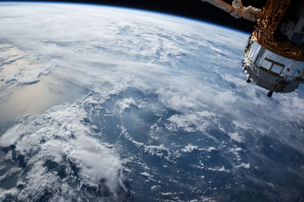
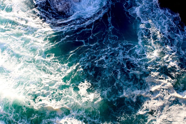
Nos Produits Earth's oceans and seas From space, we can see that the surface of our dear planet is mainly composed of water. Oceans and Seas covering a good part of our maps and we now display their names.
Team News Jawg visual identity through time We changed our visual identity after 3 years because it's very important for a brand. It helps to distinguish a brand from the crowd of other business.
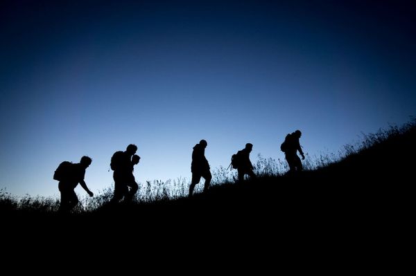
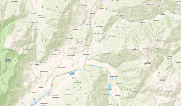
en Elevation Service Use Case: Hiking Our Elevation Service provides elevation data above the sea level for any location on Earth’s surface. This is useful for hiking, biking or motorcycling applications. In this article we display a hike on a map and then plot a chart of its height.
Nos Produits Featured Add relief to your maps Hillshade and contour: Two vector layers for relief visualisation.
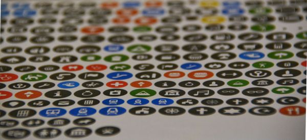
Nos Produits Do you want some icons on your maps ? Icons are deeply linked to the maps we use every day. Universal symbols, they do not suffer from the language barrier and allow to be understood by all.
Nos Produits Introducing our new routing profile It's been a long time since we introduced our car routing service. Now, we are please to announce our new routing profile: walk. This profile is focused on pedestrian routing.
Nos Produits Jawg Maps is evolving every day Discover the new features of Jawg Maps : OSM data management, transport network, hillshades, landcover ...
Parlons Tech Hillshades and Digital Elevation Model Our latest release of the Jawg Lab allows you to include the best shaded relief on your maps. Quick tutorial: Add hillshades to your style Go to the style manager [https://www.jawg.io/lab/styles]. Click create a new style and select the base style. Tick the Hillshade box
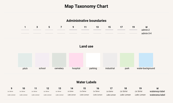
Nos Produits Introducing Map taxonomy chart with Jawg Maps Sometimes, we want to see our map style outside the map context. That's why we created the map taxonomy chart project. Jawg taxonomy [https://jawg.github.io/taxonomy] aims to view almost all your style elements in one page. This is completely compatible with our maps styles created
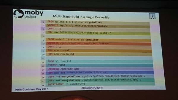
Parlons Tech Docker Multi-Stage Build On June 13, 2017 took place the Paris Container Day. At the opening of the conferences they unveiled a new docker feature : multi-stage build. That's the subject of this article. The multi-stage build requires version 17.06 of Docker-CE (released in June 2017). This feature